

Charts & Tides app for iPhone and iPad
Developer: Navimatics Corporation
First release : 03 Jan 2014
App size: 38.82 Mb
The all new Charts&Tides for iOS7 is finally here! Now get access to charts, tides, ActiveCaptain information, GPS navigation and more in a well designed package. Use it at home to research and plan your trip. Use it on your boat to navigate a route to your final destination.
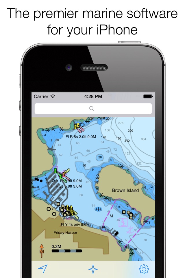
Charts&Tides was designed with ease of use in mind. The interface is intuitive and tasks have been streamlined. Unlike other marine software, you do not need to download, store and manage individual charts or load them into the software; we have done the legwork for you and compiled large area charts that combine information from multiple sources.
In more detail:
- Provides continuous and seamless large area charts derived from NOAA and CHS vector cartography.
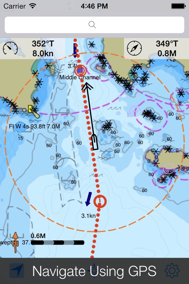
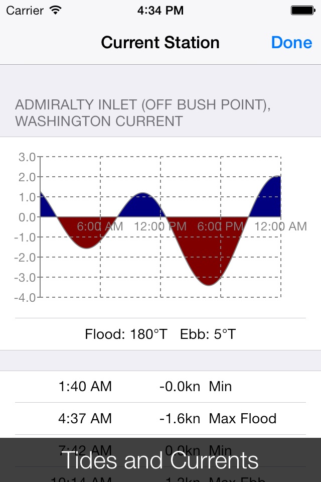
- Shows tide levels and current speeds on the chart using easily interpreted icons. Allows you to judge the water situation around you with a single glance.
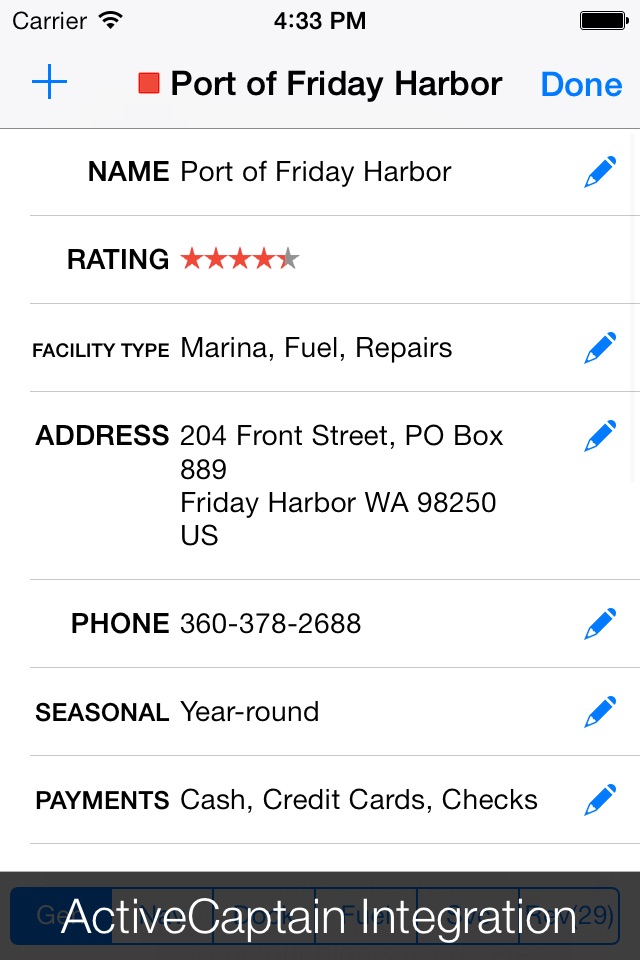
- Integrates with the ActiveCaptain interactive cruising guidebook providing you with access to thousands of marinas, anchorages, hazards and other local knowledge.
- Stores the entire ActiveCaptain database offline so that it is always available to you, even without an Internet connection.
- Allows you to instantly search thousands of chart features and the ActiveCaptain database.
- Supports waypoints, routes, tracks and allows you to import and export them in GPX format. Route navigation with automatic waypoint sequencing is also supported.
- Supports multiple options for navigation. You can use your devices built-in GPS or connect to an external GPS via Bluetooth or Wi-Fi. You can also use dead reckoning mode.
- Supports external AIS devices and performs Closest Point of Approach (CPA) computations.
- Comes with a dark UI that looks good during the day and will preserve your night vision when it is dark.
The software comes with a world base map, but does not come prepackaged with any detailed marine charts. You can purchase detailed marine charts from within the application. You can also use the software without purchasing additional charts.
Latest reviews of Charts & Tides app for iPhone and iPad
This app requires you to purchase charts. Without the charts it will show you where your boat is on a body of water and which direction you are going. It will not show you what water you are on or any river names.
I have been using the navimatics version 4.7 and decided to upgrade to 5.4. The new features are great (route function, etc.) but unlike the old version you have to purchase ($54) the charts for each device! Two emails to the developer and no response...unimpressed.
Was excited at using this app. Unfortunately, the chart wont download and it is stuck at 0%. I have reloaded the app several time and followed all instructions. I am out 19.99. If someone can help, this could be a 5 star app. UPDATE - WAS ABLE TO DOWNLOAD AFTER iPad RESET. APP IS GREAT!!
Pacific NW boater here. The app works great and just as accurate as my onboard plotter. The on screen current vectors are very helpful in planning routes. A necessity when traveling deception pass area.
Ive used the previous version for some time, and I like it a lot. I was looking forward to the update, but it turns out I cant use it without spending another $20? There is no update path for current users without basically buying it all over again.